
| |||
|
|
Top Ten Historic Sites in Stony Valley & Surrounds 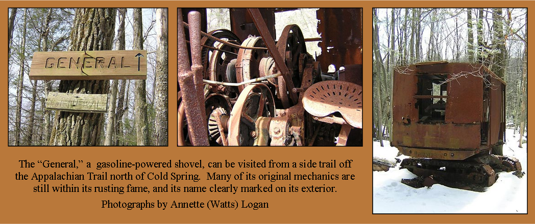 Some say it broke down and cost too much to fix during the days of the Great Depression. Others believe it was utilized for so long in the small valley, its way in had grown shut. Still some think that perhaps the coal mining was not profitable, and after the purchase of the land by the Pennsylvania Game Commission, the shovel's owners did not have the money to remove it from its valley home. Legend has it the Game Commission commissioned a nearby garage to remove the shovel; however, the plans fell through. That garage is still supposed to have the shovel's gearbox today, although with years of abandonment, the shovel is sure to make its grave along the headwaters of Rausch Creek.
DIRECTIONS: From Route 225/325 Junction, continue east on Route 325, 16.8 miles until you reach a pulloff on your righthand side. The pulloff is marked with red blazes and blue A's on the trees. Park and followed the red-blazed Stone Tower Trail. You will cross Clark's Creek on a log and gradually climb the mountain. Turn left on a salmon color-blazed trail (Sand Spring Trail), which will steeply ascend the mountain for approximately to The General. The entire hike TO the General is approximately 4.5 miles in length.
Use State Game Lands #211 Map 2 of 3
StonyValley.com was created and is maintained by Schuylkill & Susquehanna Railroad Historian, Brandy M. Watts Martin. Copyright 2013. | ||


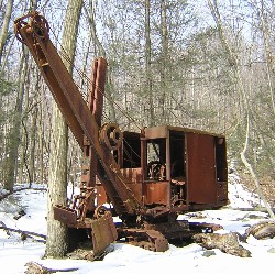 Most commonly referred to as a "steam shovel," The General was everything but. A gasoline shovel, The General was not the name of the shovel itself, but the company that manufactured it. Locked in a small valley along the headwaters of Rausch Creek, The General sat for many years after its strip mining operations were complete, but why would a shovel, which surely cost so much to purchase, be left abandoned?